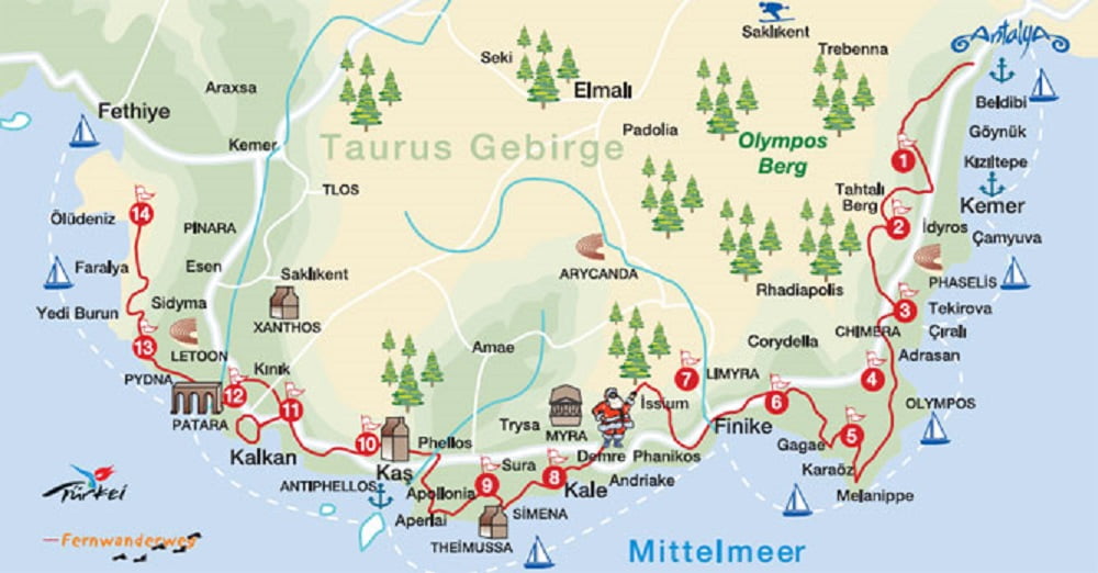
The trekking route known as Lycian Way is a 535 km trekking route from Fethiye to Antalya. This trekking route sometimes goes along the coast and at other times goes through the mountains.
General Information About The Lycian Way
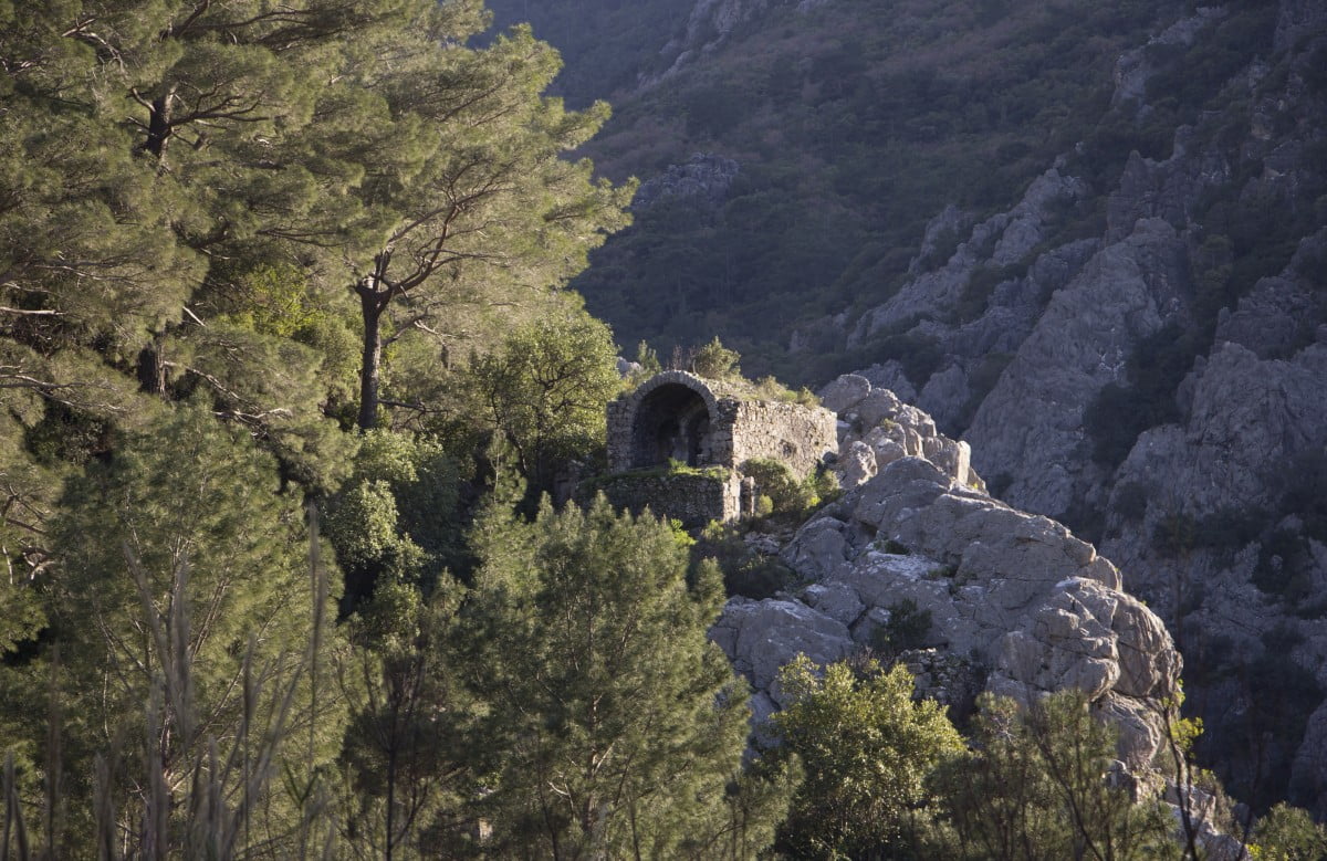
Lycia was a region on the western Taurus Mountains on the Teke Peninsula in southwestern Anatolia, where the provinces of Muğla and Antalya are located today. It was a region on the Mediterranean coast. According to historians, the people of Lycia lived in the prehistoric period of the Late Bronze Age. They established city-states such as Xanthos, Patara, Myra, Punara, Tlos, Olympos and Phaselis on the Mediterranean coast and founded the Lycian League. They had the best opportunities for maritime trade and even piracy due to their strategic location. In later periods, the region of Lycia was under the control of the Persian Empire, Ancient Greece, Ancient Rome, the Byzantine Empire, the Seljuk Empire, and finally the Ottoman Empire. The rock tombs and sarcophagi that are carved into the rock walls of the region bear witness to the Lycian civilization.
Lycian Way is also one of the best long-distance hiking routes in the world. The Lycian Way, used by the Lycians as a path and mule road, was researched and marked by amateur historian Kate Clow, a British immigrant living in Turkey since 1989, and opened in 1999.

This route is a combination of the routes in the historical region of Lycia, which is one of the most interesting regions in Anatolia. In terms of its historical and natural riches, Lycia is one of the most interesting regions of Anatolia. Ancient cities in the region, called “Land of Light” in antiquity, are intertwined with nature. In fact, the route, which consisted of independent roads, was united for the first time in the Roman period. The Lycian Way was formed in the form of a long and wide network.
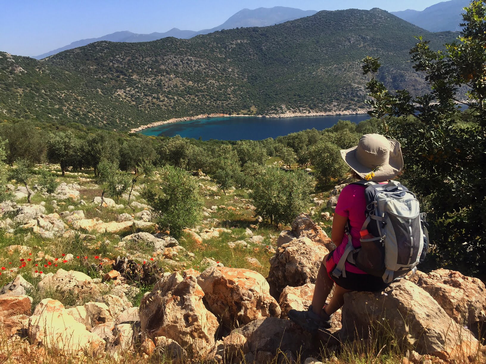
Today, it offers incredible beauties to local and foreign nature lovers.
Lycian Way Route
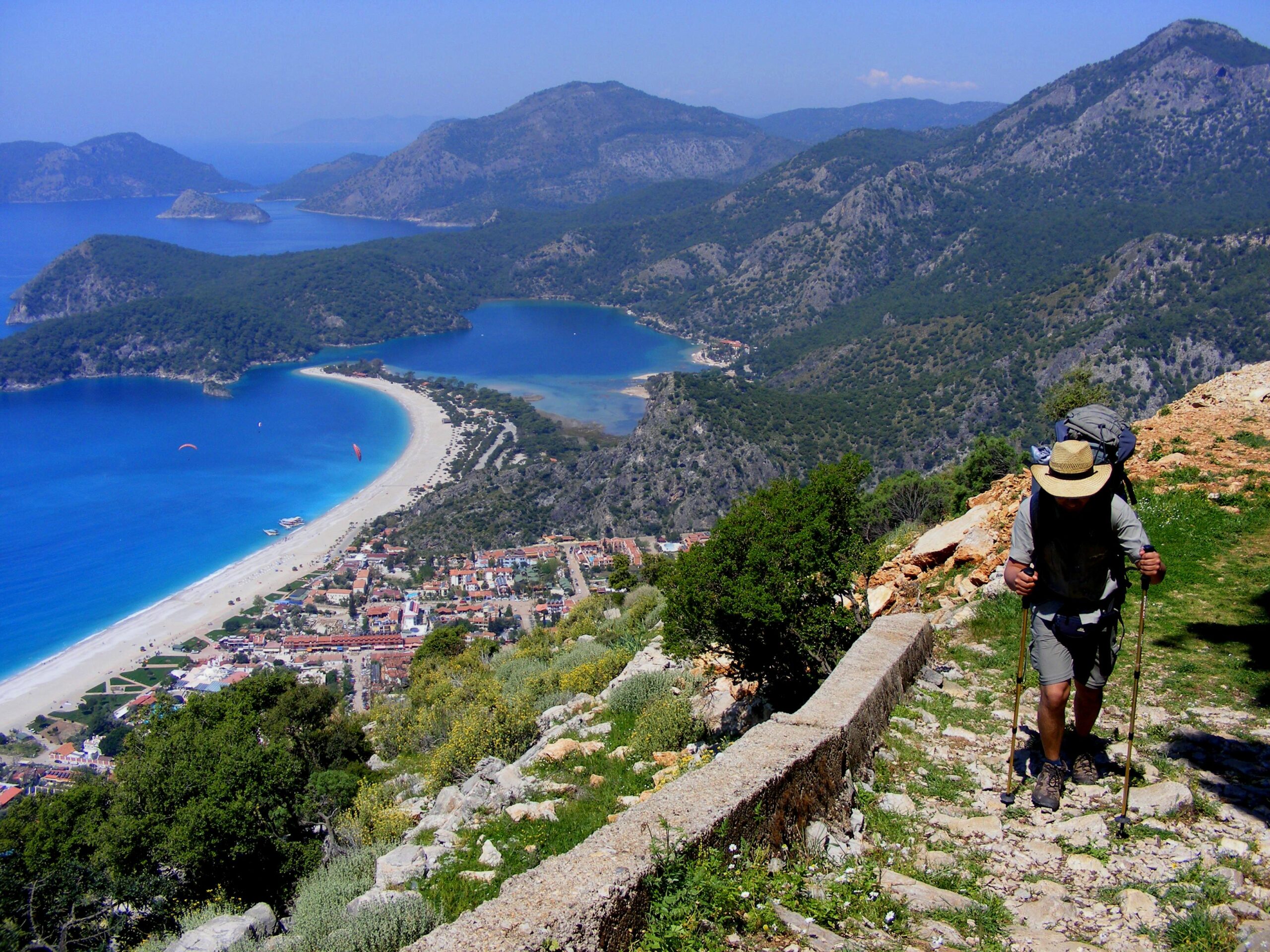
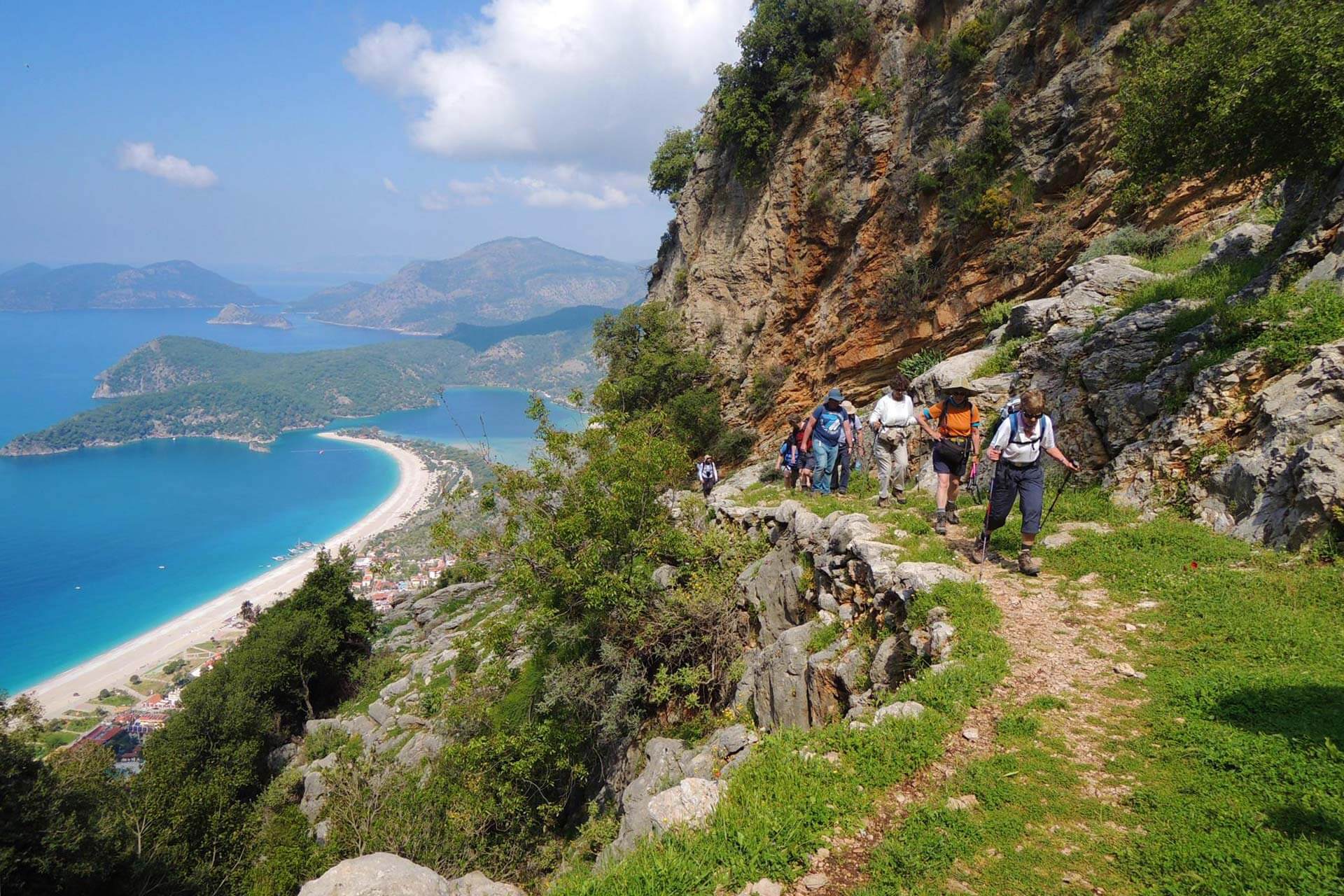
The length of the route is approximately 535 km. The entire route is marked and maintained by sponsors and volunteers. The Lycian Way route is marked with red and white paint from start to finish, so there’s no chance of getting lost. However, it’s better to have a map with you, as the markings can be erased or far away in some places.

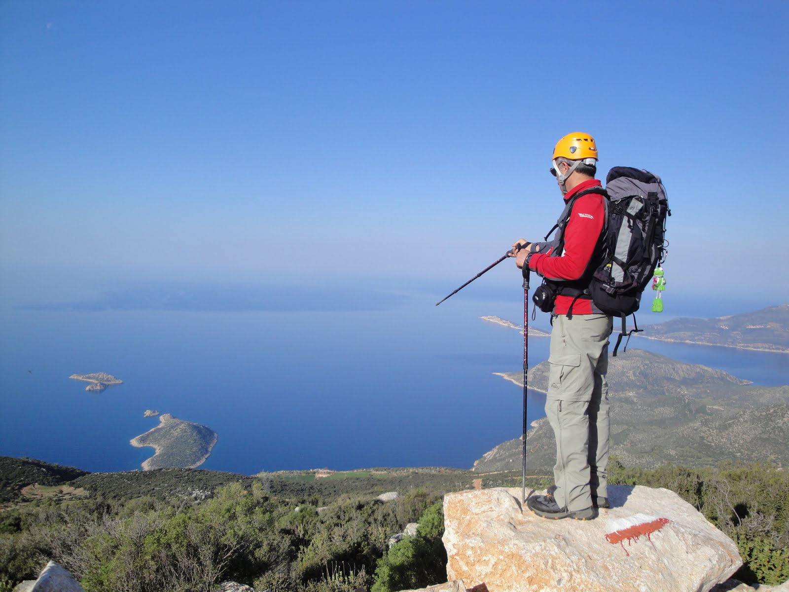
The route has been classified as medium to difficult. It has many ascents and descents as it approaches and turns away from the sea. However, keep in mind that in some areas there are rocks that must be dropped and walked, while in some areas there are areas that can only be crossed by rope.
To walk all the way to 540 kilometers takes about 40-45 days. However, as many hikers do, you can walk a portion of the trail.
Is the Lycian Way Trekking Safe?
The route of the Lycian Way is extremely safe. There are no serious dangers except for animals such as scorpions, snakes, and pigs. However, it is also a good idea to take a first aid kit with you.

Do I Need a Guide to Trek on the Lycian Way?
There are trekking tours on this route organized by some travel agencies. However, it is also possible to do the trek without a guide, either as an individual or in a group. Road signs are sufficient. However, the GPS coordinates of the trekking route and the applications of mobile phone maps are also common. The application of the Culture Trails Society, the Lycian Way application is very helpful.
Equipment: What should I bring to Lycian Way?
Soft-soled, ankle-hugging hiking boots made of waterproof and breathable fabric, quick-drying pants and socks, shirts made of moisture-proof fabric, hood, neckerchief, raincoat, spare clothes and underwear, sunglasses, sunscreen, and rucksack are the recommended equipment for the Lycian Way hikes. It is also a good idea to bring a bathing suit and towels.
Other useful items include a compass, map, whistle, penknife, headlamp, camera, lighter, extra battery, small first aid kit, and mobile phone.
How hard is the Lycian Way?
Some parts of the Lycian Way are suitable for hiking with mountain bikes. In some places, experienced downhill and single-track enthusiasts can carry the bike on their back and cross the entire track.
Where To Stay on the Lycian Way…
There are hotels in many places along the trek route. For treks/hikes organized by an agency, accommodation is usually provided at one or more hotels. Your belongings will remain at the hotel. They will be transported to the next destination by the agency.

Another option is to stay in a hotel and carry what you need while trekking. The last option is to choose to camp somewhere along the trekking route. But in this case, you will have to carry your own bags and materials.
Highlights of the Lycian Way
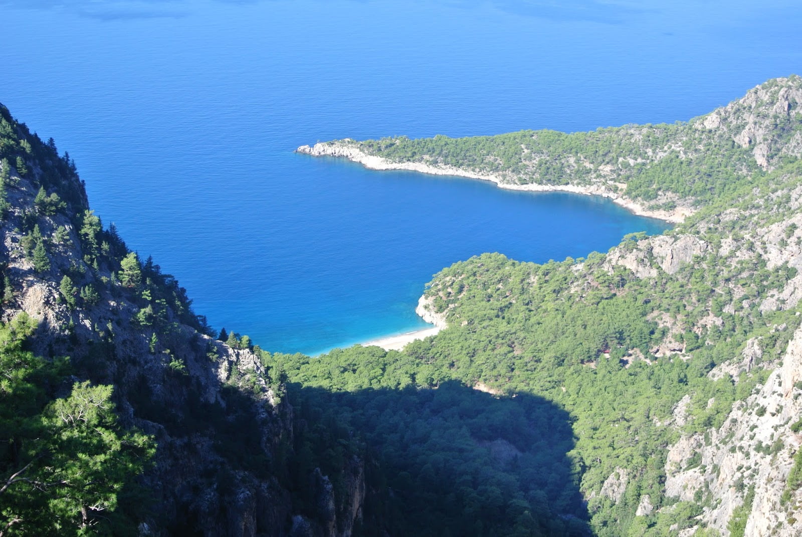
The cliffs of the Butterfly Valley, the beach of Patara, the spectacular view of Baba Dagi, the breathtaking descent to Faralya, the ascent of Mount Olympos, the splashing in the canyon of Goynuk.
Ancient Cities on The The Lycian Way Route
Some ancient cities on the walking path starting from Fethiye: Sdyma, Pyndai, Phellos, Apelia, Theimussa, Letoon, Xanthos-Letoon, Patara, Antiphellos, Apollonia, İdyros, Simena, Demre (Myra), Lymra, Gagae, Olympos, Sura, Belos, Phaselis.

Which is the best season for the Lycian Way walk?
The Lycian region is very hot and humid during the summer months. The region is characterized by hot, dry summers and mild winters with low annual rainfall due to the predominance of the Mediterranean climate. The hiking season is long, but the best time to hike is in the spring when the hills are still snow-covered and the landscape is blooming. Therefore, spring and fall are the best seasons to walk this route. March, April, October, and November are the most ideal months.
In the fall season, when the temperature and humidity gradually decrease, the months of October and November are also pleasant for hiking. You can experience all four seasons in one day at high altitudes and mountain peaks. From mid-May to mid-September, the lower elevations are quite hot for hiking. Rain and storms can be experienced in the months of December and January. From January to early April, snow is common at elevations above 1,500 m (4,900 ft). Rain showers are possible from November to February. If you have plans to swim during the trek, you can choose May or September as your trek time.